The cities, the regions
and the countries
to travel and to work

The world, the continents
and the countries always
in front of your eyes

The world in 3D
for the fittings
and the study

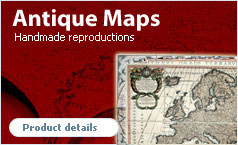
The past and
the future
of the cartography

To travel and to know
where you are going.
And many others…


Last products

World (in 3 sheets) classic political - wall geographical map
Editor / Manifacturer: National Geographic
€ 108.86
World executive political - wall map
Editor / Manifacturer: RAY & Co.
€ 20.75
World political (antique style) - wall map
Editor / Manifacturer: RAY & Co.
€ 20.75


Products highlight

Sezione ripiegata della carta topografica d'Italia Serie 25/25DB - topographic map
Editor / Manifacturer: Istituto Geografico Militare
€ 9.36
World political/physical (scholastic map) - wall geographical map
Editor / Manifacturer: Manifattura del Tigullio
€ 27.00
-20 %
Scratch Map Deluxe - The World
Editor / Manifacturer: Luckies of London
€ 39.65 € 31.72
-15 %
Gold classic 30 ver. italian - geographical globe
Editor / Manifacturer: National Geographic
€ 97.00 € 82.45
Kyoto and west Japan - road and tourist city plant
Editor / Manifacturer: ITMB
€ 11.28
Thailand - road and touristic geographical map
Editor / Manifacturer: ITMB
€ 12.26
World political XL - wall geographical map
Editor / Manifacturer: Lovell Johns by Maps Int.
€ 39.24
Europe classic political - wall geographical map
Editor / Manifacturer: National Geographic
€ 29.38
-15 %
Astra 30 - geographical globe
Editor / Manifacturer: Nova Rico
€ 75.00 € 63.75
World executive political Small - wall geographical map
Editor / Manifacturer: National Geographic
€ 24.03
-15 %
Primus 30 - geographical globe
Editor / Manifacturer: Nova Rico
€ 92.00 € 78.20

DIPARTIMENTO DEL MINCIO DELLA REPUBBLICA ITALIANA MALLES VENOSTA 11 - Foglio ripiegato della carta tModern line globesCARTA FORESTALE DEL REGNO D'ITALIA... - Foglio 26 MONTE BASODINO 019-020 - Foglio ripiegato della caZielHYPSOMETRISCHE KARTE DER OST ALPEN (Carta ipsometrFolded maps AfricaREMEDELLO 61 I NE - Tavoletta stesa della carta toNOUVELLE CARTE GEOGRAPHIQUE ET DES POSTES DE L'EURAntique globesCALTAGIRONE 639 - Foglio ripiegato della carta topRough GuidesMAPPE CATASTALI D'ITALIA - PROVINCIA DI BRESCIA - CARTA TOPOGRAFICA DELLA CIRENAICA ALLA SCALA DI 1:MINUTE ORIGINALI DI CAMPAGNA DELLE LEVATE AL 20.00Satellite digital imagesCOSTA DI BENGASI - QUADRO D'UNIONE.Servizio a vapore (vol.1)Compagnia ForesteBangkok and Greater Bangkok - road and touristic gSASSO MARCONI 237 - Foglio ripiegato della carta tBuronzo 115 II - Sezione ripiegata della carta topCARTA DEI DINTORNI DI VALENZA - FOGLIO 11White StarITINERARIO ESC SCIUEREF-BRAK - 7 TAPPAPunta `e Lattone 518 IV - Sezione ripiegata della Full Circle Vision Silver 30 - geographical globeCAPRACOTTA 379 - Foglio ripiegato della carta topoPIANTA TOPOGRAFICA DELLA CITTA' DI NAPOLI ALLA SCAKummerly + FreyISOLE ITALIANE DELL'EGEO - ISOLA DI RODI - TriandaATLANTE GEOGRAFICO DEL REGNO DI NAPOLI DELINEATO PCARTA DELLA CORSICA - FOGLIO 1 II III - LURIPIANTA DELLA CITTA' DI ANAGNICONFINE DI STATO ITALO - JUGOSLAVO CARTOGRAFIA DELGizi MapL’isola di Sicilia divisa nelle sue valli, CassiATLANTE DEI LAGHI ITALIANI TAV XVI 2° COPIA LAGHICARTA FORESTALE DEL REGNO D'ITALIA... - Foglio 117ATLANTE DEL REGNO DI NAPOLI RIDOTTO IN VI FOGLI DACARTA DELLA COLONIA ERITREA. I.G.M. - Foglio 21- Ze-GEOS (by Gis Italia)SANTA FIORA 129 III NE - Tavoletta stesa della carRother BergverlagALBANIA RILIEVI IGM - TIRANE ( TIRANA )TERRITORIO COMPRESO TRA RACCONIGI, MORETTA, SAVIGLAtmosphereTreccaniCampo Lìgure 213 IV - Sezione stesa della carta tPIANTA DELLA CITTA' DI MILANOI. DIE KRATERTERRASSE DES STROMBOLI AM 30 JUNI 193Folded maps AustraliaCARTA TOPOGRAFICA DELLA LAGUNA DI VENEZIA SCALA DIFolded maps MondoRand McNallyEdizioni PegasoExpressMapMural maps Educational and Toys mapsNavigatorsJupiter with the Galilean Moons (card with 3D pictCARTE DU PIEMONT ET DU MONFERRAT...CARTA DELLA COLONIA ERITREA LIMITI AMMINISTRATIVI CAVANELLA D'ADIGE 65 II NO - Tavoletta stesa dellaNellesAstronomicalCARTA TOPOGRAFICA DELLA LOMBARDIA, VENETO E ITALIARelief globes traditional cartographyCARTA ITINERARIA D'ITALIA PER GLI ALPINI NORMALI DGlobes